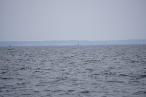
ICW Mile 202: Beaufort, NC

Supermoon Over Bear Creek, NC
We finally made it to Beaufort (pronounced BO-fort), the first place where we can finally go offshore into the ocean and out of the infernal ICW! Yesterday was a relatively short, calm day that became downright warm as we anchored in Bear Creek. Today we decided to get all the way down to Beaufort, about 40 miles and 7 hours of motoring. It started out very rainy and windy, up to 30 knots (predicted to be 10-15) and some big waves. But after a while it settled down and became calm and balmy. We went under yet another bridge, timed to go under at low tide, but had zero problems getting under it.
After many hours of motoring, we were a bit frazzled as we came to the last section into Beaufort. As we came in we were greeted by a huge uncharted bridge under construction. It was about 68 feet high so no problem getting under it, but right before the marina they were also doing construction in the channel and all the navigation markers were messed up. The marina directed us in and Shelly got Good Karma into a tight, difficult slip with no problem. She looked downright professional!
We are in Beaufort for at least two days, shopping, working on the boat and recovering from the last week of ICW “magic.” At least it won’t freeze here!

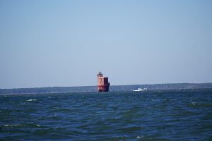
Good Karma at Beaufort, NC!
Posted in Sailing by Mark with comments disabled.
ICW Mile 136: Belhaven, NC

Hooked A Champion!
Look closely at the above picture and you’ll see a five foot long log. It is hooked underneath the anchor, our trophy from last night. Here’s the story:
Went to bed just south of Cypress Point last night in perfectly calm, glasslike conditions. We knew there was a forecast for increased wind overnight starting at about midnight and we were in a relatively exposed position to north or south wind. There aren’t any well protected anchorages in this area for quite a distance. We weren’t too worried because the anchorage was recommended as having good holding, the forecast was for wind from the northeast, not north, and it was very peaceful early in the evening. What could go wrong?
About midnight, the wind picked up and the boat started rocking a lot. We got up to check things out and it was very wavy with lots of wind under the full supermoon. We noted our position by looking at the slow flashing red lights of the navigation beacons off the port side. They were in the same place as where they were when we went to bed, so the anchor was holding. Shelly got a bit worried and so got dressed just in case we needed to get up and take care of the boat in the middle of the night. I just went back to sleep.
It continued to rock quite a bit but we did get some sleep. I woke up at about 2 a.m. and went up to check our position again. The wind had picked up even more and the water looked very chaotic. Our position was still ok, the red flashing navigation markers were in the same place off the port side. I went back to bed.
The rocking action of the boat decreased somewhat for the next hour and changed from front-to-back to side-to-side, a much easier ride. After a while I got a bit curious about the side to side rocking and wanted to check the wind speed, it seemed higher than predicted. The time was 3:15 a.m. I looked out and did not see the red flashing navigation beacon where I expected and noticed the moon was setting behind the boat. I thought the wind must have shifted direction and we were pointed more to the east. If that were the case I should see the red flashing light off our stern and there was nothing back there. Hmm. I looked some more and saw a red light in what I thought was the correct place and so my concern subsided. But why was the moon in the wrong place?
I went below to turn on the chart plotter which would show me exactly where we were. Well, it told me we were about one mile from where we started. A nautical mile. On top of that it showed we were drifting at about 1 mile/hr, dragging the anchor. That was NOT good. These “magic moments” always happen at 3:30 a.m. for some reason.
I got Shelly up and we donned full battle gear, including life jackets, and went to work getting control of Good Karma. It was rocking quite a bit and the wind was blowing over 20 knots. The moon was almost down so not much light. Shelly went forward and worked on getting the anchor up, a tough job made more difficult by the cold, high wind and rocking waves. I got the motor going to take pressure off the anchor chain. After about 10 minutes Shelly got the anchor onto the deck.

AIS Track
The pic above was taken from our AIS track and shows how far we dragged across the channel. We’re moving south, toward the bottom of the pic. The drag part of the track is the right-to-left going down slant in the “Z” shape in the center. We anchored at the top corner of the Z and got control at the bottom corner.
It was then 4 a.m., first light would be at 6:10. We decided to continue running down the channel at slow speed rather than try to anchor again in those conditions. Off we went, navigating by instruments and the few lighted navigation beacons, hoping not to run over a crab trap. Every time the chart plotter showed an unlighted navigation pylon, we would spot light it with our powerful flashlight. It was very difficult to keep in the channel with the waves and the wind, but not impossible. We slowed down as much as we could so as to not try to cover a lot of unseen territory, remaining in the channel and waiting for daylight. The wind was freezing, but we had fairly good protection under the cockpit canvass.
We had two hours of dark navigation. We heard on the radio other boaters who “went to sleep on one side of the channel and woke up on the other side.” Adding to the eeriness, the Coast Guard was periodically broadcasting a “pan-pan,” to be on the lookout for a boat in distress further down the channel, based on a signal flare seen at 2 a.m. The sky started to glow as we got to the Alligator Canal, our next canal section about 15 miles long.
The wind died down to near zero in the canal and the sky brightened. Our moods brightened with the sky. Shelly made some hot coffee and a breakfast snack (thank you!) as we calmly cruised down the channel. She said, “check out the log on the anchor.” She had told me about it long ago but now it was very visible. Our anchor hooked that log and is likely why we drug so far, the anchor couldn’t dig into the mud.
Lastly, as if that wasn’t enough excitement, we were approaching the notoriously low Wilkerson Bridge. It is the bridge that has a reputation as being lower than 64 feet. The waterline scale showed on approach that it was about 63.5 feet. We approached and things otherwise looked good, no other boats in sight to cause wake waves and bounce our mast into the bridge. We held our breath and passed under it. Did not even touch the top of the antenna! My measurement of our top-of-antenna mast height was 63.5 feet was accurate. Just slipped under!

Wilkerson Bridge Behind Us!
Today we’re anchored at Belhaven, which looks like a cool little town to visit but we’re too cold and tired to get off the boat tonight. Some other trip.
Posted in Sailing by Mark with 2 comments.
ICW Mile 90: Cypress Point on Alligator River, NC

Alligator River Swing Bridge Opening Ahead
Today we woke up to about 50 degree weather today and crossed the Albemarle Sound, a relatively open body of water about 15 miles wide. It was a bit windy and we got our share of waves, but there were only a few crab pot floats which can be a problem in this area.
As soon as we approached the far side of the sound the wind died down and it warmed up nicely to just under 70 degrees. It was a nice break from the string of chilly days we’ve had. Unfortunately, tomorrow is going to be much cooler again.
We entered the wide Alligator River where apparently a few have been seen. More common are swimming black bears. Really. We haven’t seen one yet but the day isn’t over. We went through the Alligator River Swing Bridge which opened immediately upon our radio request. It’s kind of cool, they stop all the traffic for about 10 minutes to get the bridge open, wait for you to go through, and close again. Like waiting for a train at a railroad crossing I guess.
Tonight we are anchored at a spot that looks very similar to the spot we were in last night. The shoreline is wilderness, there are no other boats around and it’s very peaceful.
Amazingly, the AIS is still working. This is where we are. If you click on the “track” button on left you can see our track which is accurate. You can probably see our progress in real time as we are underway during the day.
Today was not too long and the next few should also be reasonable.
Posted in Sailing by Mark with comments disabled.
ICW Mile 57: Buck Island in North River, North Carolina

Cruising the Long, Straight Albemarle and Chesapeake Canal
It was a long and winding voyage today. And cold. I’m beginning to think the “IC” in ICW stands for icy. Well, I guess we waited a little longer than most but it seems a bit colder here than it should be. The good news, we are getting further south! Traversed about 45 miles of the waterway today and it took about 7 and a half hours. Went through two swing bridges and under three more low 65 foot bridges.
We are continuing to find that the waterway is kind of a traffic nightmare. We’ve met some very friendly, helpful boaters as well as total jerks. The jerks have all been in power boats. Not all power boaters are bad, but there are definitely bad apples who pass you with big wakes and don’t signal. Much of the waterway is a narrow dredged channel so passing has to be done in close quarters. When a power boat zooms up to your stern and then slows to pass, they usually throw a wake wave which knocks your steering off. This is not a legal maneuver but there’s always a power boater willing to piss everyone else off, including other power boaters.

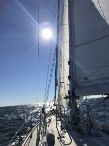
It Became Sunny but Windy as the Day Progressed
We swapped steering duties every hour so that we wouldn’t get too tired. Keeping in a narrow channel, even those that are straight-line for miles, is more difficult than it sounds. Wind, currents and waves constantly mess with your course and you have to correct. Lots of winding through rivers as well.
We finally arrived at our planned anchorage near Buck Island. It was pretty windy when we arrived but has subsided a lot. No worries about the tide in the waterway here, but the wind can push water in and out. We’ve had north wind most of the day but the depth here is 10 feet, great for anchoring.
The AIS data is apparently working well in this area and this is where we are.

Our Lonely Anchorage for the Night
Posted in Sailing by Mark with comments disabled.
ICW Mile 12: Portsmouth to Great Bridge

Gates of the Lock Closing in Background
Today was unique and very busy watching for other traffic and communicating on the radio. We left the marina in Portsmouth and headed down the most congested section of the ICW, though not so bad for us as most of the private boat traffic is about three weeks ahead of us. The first bridge was right out of the marina, a railroad lift bridge that is normally open, but was closing as we approached. It wasn’t for a train but for maintenance. We circled around for about 45 minutes until they opened the bridge. A tug with a huge barge asked us to move out of the way while we were sitting there (thanks AIS). You can’t just pull over and put the breaks on, you have to do fine maneuvering, which is difficult in a sailboat like ours. Essentially, we sit and slowly spin clockwise to keep in place. There were about 5 other boats waiting with us, making it fun avoiding them.
When they raised the bridge, they took it up to only 65 feet. This was a great test for our mast clearance. We got under it and man was it close. A few miles later we went under another 65 foot fixed bridge and dinged the very top of our antenna. No problem, but we know that going under the 64 foot bridges ahead we will bend the antenna a bit. Shouldn’t be a big problem. We think.
We steered down the narrowing waterway until we got to the Great Bridge Lock. This is the only lock we have to go through. They open the gates at about 15 minutes past the hour, you get into the lock and moor your boat to the side right behind the boat in front of you (pictured above). They then close the back gate and open the front gate. The water rises a couple of feet and you proceed out to another bridge that is coordinated to open shortly after the lock fills. When that bridge lifts, you have fun avoiding the northbound traffic trying to get into the lock.

Shelly Guiding Good Karma Out of the Lock
There are docks just outside the lock and we easily picked up a place for the night. We are at a place called Great Bridge, an important historical location as this was where the British forces were first defeated in the Revolutionary War.
AIS reception seems to be working well and so this is where we are today.
Posted in Sailing by Mark with comments disabled.
Mobjack Bay to Norfolk, VA: ICW Mile Zero

Shelly Bringing Up the Staysail to Dry Out Before Storage
We are spending election day here in Portsmouth, Virginia, across the river from Norfolk, getting prepped for the long haul down the ICW and avoiding the news. Yesterday we had another wild, windy ride from Mobjack Bay to mile zero of the ICW. Lots of wind and waves! We even had a lone dolphin check us out, jumping out of the water between the 5-foot waves.
We are now officially out of the Chesapeake Bay, having sailed nearly the entire length. We entered the Elizabeth river, the beginning of the ICW, and man is it busy here. This is one of the busiest shipping channels in the U.S., with the naval station and shipyard, as well as lots of commercial traffic.

Aircraft Carriers at the Shipyard
Luckily, there wasn’t much commercial traffic and as planned, not a lot of private traffic heading to the ICW. There were several barges we had to avoid in the channel, as well as the container ship below. That container ship came out of one of the side yards and turned right in front of us. Well about a mile in front of us, which is pretty damn close. You have to pass almost next to them in the channel. Exciting.

Watch Out, Container Ship Being Towed Out!
Tomorrow we head down the ICW, going under a bunch of bridges and through the one lock on this section of the ICW. We’ll only get about 12 miles, but it should be one of the more difficult portions of the waterway. Got to keep moving, it got down to 40 degrees F last night. Might as well be winter camping in Colorado…
I see that vessel finder is working here because this is where we are.
Posted in Sailing by Mark with comments disabled.
Dolphins and Lighthouses
Wolf Trap Lighthouse
Today we sailed from Fishing Bay to the East River in Mobjack Bay and got in a great sail as well as some interesting sights. The pick above is the Wolf Trap light. Apparently you could have bought this on Ebay a few years back, and it’s still for sale according to Wikipedia.
Abandoned Lighthouse at Mouth of Mobjack Bay
We passed another abandoned lighthouse on the mouth of Mobjack Bay. I know nothing about this one. Maybe you can move in for free?
We had good north winds today and our sailing direction and wave motion made for very smooth and fast sailing, almost 9 knots at one point. Here is a video of how fast and smooth we were moving.
The other cool thing that happened today was twice we were visited by two different pods of dolphins. The first was in the morning as we were leaving our anchorage. The would swim right up to the boat, jump out of the water while looking right at us. We saw at least ten in this first pod. Later, another pod of about ten swam up to follow us as we were sailing. Fortunately I was able to get them on video and here it is!
Posted in Sailing by Mark with 1 comment.
Mill Creek to Fishing Bay
Staysail Works!
The voyage of the Good Karma continued today to Fishing Bay, Virginia. We had more moderate wind today but enough to test out our staysail. This is a foresail you use in place of the jib, which is the front sail on a sailboat such as ours. The mainsail is the largest sail that is behind the mast, while the jib and staysail are in front of the mast. In the picture above you see a sliver of the white staysail. In front of it is the jib rolled on the front stay, it looks like a thick bar running vertically to the left of the staysail. The staysail is used in higher wind conditions to get better performance than a reefed the jib. On this type of boat you use either the jib or staysail but not both at the same time.
We really needed the staysail yesterday in the 25 to 30 knot winds we had but the wave action was too wild to put it up in those conditions. You kind of have to anticipate when to use it, at least we do at this point in our learning curve.
Today was shorter, about 35 nautical miles and far less windy which made for a very enjoyable ride.
Tomorrow we move again.
Posted in Sailing by Mark with comments disabled.
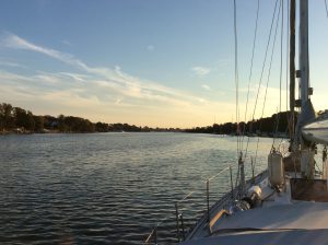
Solomon’s Island to Mill Creek, Virginia
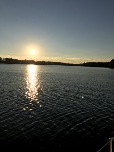
Sun Setting on Mill Creek
We spent four nights at Solomon’s Island where we were visited by our friend Martha, a sailing buddy Shelly met many years ago and has sailed with all over the world. She stayed the night but we didn’t get out to sail. There wasn’t much wind anyway. The weather was very nice, with autumn temperatures in the 70s with lots of sunshine.
On November 4 we continued our run down the east coast. We had a long way to go today, about 50 miles to the next possible anchorage. Fortunately we had a lot of wind blowing in the right direction, from the north, kind of like when we sailed out of Annapolis. At times we were getting up to 7.5 knots with reefed sails, extremely fast for out boat. Lots of waves too, I would guess at least five feet at times. Here is a video of Shelly at the helm when she notices a 24 knot gust with 4 foot waves in the background. It was cool but not really cold, the only time I felt chilled was when I got soaked by spray blowing over the cockpit. Here a video of Shelly on the foredeck getting some things straightened out. Looks relatively calm but notice the horizon angle. That isn’t the world moving, that’s the boat rocking in the waves.
It took us about seven-and-a-half hours to get here, a tiresome day in those conditions. Shelly was expecting it to take at least nine hours, but because we had so much wind we got here a lot faster. On the way we crossed twelve mile wide mouth of the Potomac and are now in Virginia! Goodbye to Maryland for a year (if not longer). Tonight we are anchored at Mill Creek in Virginia just south of the Potomac (this is the third “Mill Creek” we’ve been to).
The next couple of days are fairly long but not as long as today was, looking forward to getting much further south where it is warm!
Posted in Sailing by Mark with 2 comments.
Scary Stuff!
Look Close, You Can See the Leaning Sharps Island Light… Where Is The Island?
I write this on All Hallow’s Eve… Also known as Halloween! We are anchored in Mill Creek near Solomon’s Island. No trick-or-treaters SO FAR…. Not so scary here yet so I will recount some scary encounters we have had on our trip so far…
Maryland. One of the scariest states in the nation. Why? Think Blair Witch Project. It takes place near Blair, Maryland, a fictitious town on the site of the real town of Burkittsville, Maryland. Well, when we visited the Antietam National Battlefield last summer, a scary site in itself, it was CLOSE TO BURKITTSVILLE! We might have even driven through Burkittsville. I don’t remember, I was too freaked out at the time to remember those little towns.
Then there was two days ago as we passed the Sharps Island lighthouse. At one time there was an island here, but not any more. And the lighthouse, pictured above, has a freaky history. From Wikipedia:
The first lighthouse was built on Sharps Island in 1838, but due to the island’s erosion it was moved in 1848. This was replaced with a screwpile lighthouse in 1866 near the original location of the first structure.
The second lighthouse lasted until 1881 when it was forced off its foundations by an ice floe. It floated nearly five miles down the Chesapeake—with its keepers still inside—until it ran aground, allowing the men to escape unharmed.
The current light, a sparkplug lighthouse, was constructed in 1882… Leaning by about 15° since it was ice-damaged in 1977.
And now, no more island. Disappeared. Scary.
Anchorage on Mill Creek
Other Halloween-type things: On Mill Creek, where we are currently anchored, monstrously big, beautiful houses. Last night our anchor held in the evil wind. And today, we took the dinghy into town. Walked down the main street to a marine store where we bought some supplies, pictured below. These talisman’s keep the evil spirits of worn parts at bay.
Oh, and for would-be trick-or-treaters at our boat: Shelly says the candy is stale (though I’m eating it)…;)
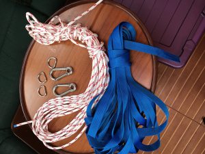
Talismans: D-rings, Eyed (of Newt) Carabiners, 5/16ths Line and 1-Inch Webbing
Posted in Sailing by Mark with comments disabled.